Working with open data
Open data is a trending topic, but what are the benefits of defaulting to it as a standard for your work? In this long read, Gala Camacho (Co-Founder and Data Scientist) and Veronica Barbaro (Principal Planner) explore how using open data can add value to and improve place-making projects.
Open data is a trending topic in civic technology. It is now commonplace for public sector bodies to have open data portals, with dedicated teams maintaining this data. But open data is not solely a product of government. There are many open datasets produced by communities, organisations, and private companies. And yet the value of using open data is not always considered in planning projects. Why?
Habit, and not knowing how to implement the use of open data, may explain this. For overstretched local authority planning teams, the switch to open data may seem overly risky and time-consuming. For technical consultancy teams, there may be concerns about moving away from familiar data-gathering exercises. Others may fear open data is likely to be incomplete or untrustworthy.
The benefits of using open data to inform both planning policy development and planning projects extends well beyond the value of a single piece of work. A serious consideration for defaulting to open data and introducing closed data as necessary, is, we think, well overdue.
At Diagonal, we believe in using open data to inform the place-making process because we know it brings value to projects, communities impacted by a project, and future projects. That’s why we are passionate about demonstrating why open data should be the starting point for all transparent data-gathering endeavours.
A useful open data source
A great example of a worldwide open datasource underutilised in the city planning process is OpenStreetMap (OSM). Let us explain why we know it would help anyone working in this space.
What is OSM?
OSM contains crowdsourced volunteered geographic information (VGI) data about roads, trails, cafés, railway stations and more, across the globe. It is community-built, so anyone can use the data (as long as they credit it), and anyone can learn to edit, update, and add to it1.
OSM is already used by planners and built-environment professionals, including for humanitarian responses, mapping previously un/under mapped areas, for general web maps, thematic maps, and route planning2. It is also widely-documented3 and supported by the OpenStreetMap Foundation.
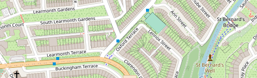
OpenStreetMap at (55.95542,-3.21381), explore here.
The practical case for using open data as a default
The benefits of using a datasource like OSM as a default, over proprietary or published data (such as Ordnance Survey), extend far beyond the project, into the community and to future work.
- Ownership - As anyone can improve, build and add to the data, people get to play a part in shaping the places where they live, work and play. When people can see and edit the data that underpins decisions about their communities, it allows them to feel part of, and influence, the place-making process.
- Trust - Involvement with the data can result in greater trust and understanding in project and policy outcomes and help bring local communities on board from the project outset. Such transparency over local information gathering can also increase representation and spread accountability.
- Positive investment - When the data is not complete, project budget can be used to complete, update, and improve it. This expense, different to when data is simply bought for a project, has positive trickling-down consequences. It can bring temporary employment to local people through mapping, and allow planners to engage with (or develop a community of) local mappers to maintain data in the future.
- Future investment - Making data better and more available for community and industry use helps encourage grassroots innovation, and can help provide more evidence of local value. Also - anyone can build upon the data and your analysis as there are no restrictions to others using the data you used for your project, or any derivative data created from it.
- Interconnectivity - Open data can be used for individual or multiple projects. It can break down silos, and enable metrics to be used or compared across projects, as the data consistency makes projects interconnectable.
- Reproducibility - Any analysis can be reproduced in different geographies since the dataset expands beyond statistical boundaries. This has benefits in varied dimensions: efficiency gains, comparable analytics across projects, process automation, etc. It also allows for the reproducibility of the project itself, making it more transparent and auditable.
- Democratic - Using open data to inform planning policy creates a more democratic planning system that better reflects the situation ‘on the ground’. It can also enable a more robust evidence base to inform initial feasibility exercises.
- Co-production - Using open data in planning/masterplanning/urban design stops these practices becoming top down, or ‘expert vs community’, moving towards co-production as standard, which offers shared responsibility for change.
- Availability - If a larger geography was considered, either for comparison or as part of some greater collaboration, OSM data is present worldwide!
The philosophical case for using open data as default
We are not the first team to think about the benefits of using open data. There is a bigger, more philosophical, conversation about ‘why’ open data as a default is a beneficial approach for everyone involved.
Principles such as the FAIR Principles and the CARE Principles, explained below, align nicely with what is usually considered best practice in planning, particularly when considering bottom-up approaches.
The case for open data is supported if we consider the FAIR Principles, which state: data should be Findable, Accessible, Interconnectable and Reusable. Within the ‘A for accessible’, the quote “as open as possible, as closed as necessary” is often used. If we extend this ethos from the making of data to the use of data, then we can ask:
Within planning projects, could we be starting with open data and only turning to other data when we can show open data yields an infeasible project path?
Similarly, the CARE Principles, which were designed to extend the FAIR Principles for the purpose of Indigenous data governance, provide useful guidance that we feel can be extrapolated to the general community.
CARE stands for: Collective benefit, Authority to control, Responsibility and Ethics. Regarding ‘collective benefit,’ the full CARE Principles state:
‘Data enriches the planning, implementation, and evaluation processes that support the service and policy needs of Indigenous communities. Data also enables better engagement between citizens, institutions, and governments to improve decision-making.
‘Ethical use of open data has the capacity to improve transparency and decision-making by providing Indigenous nations and communities with a better understanding of their peoples, territories, and resources. It similarly can provide greater insight into third-party policies and programmes affecting Indigenous Peoples.’
Planning proposals should reflect the needs of the communities they affect. Therefore:
Isn’t the default to open data in the first instance the option most aligned with best practice and values in this area?
How can we help?
We are passionate about the benefits of using open data as a default option and keen to talk with built-environment professionals about the value it can bring. Our aim is to facilitate this change by demystifying using open data and helping anyone interested in using open data, whatever their knowledge or experience.
We know that when it comes to analysing more than a single set of data sources, connecting all the data together to analyse it in a meaningful way can be tricky - this is what the Diagonal geospatial computation engine has been built for. To find out more about our technology, take a look at our case studies, or reach out!
—
Our commitment to openness is broader than just for data. To find out more about how we build open systems and principles into all our work, see our internal charter.
Notes
-
Have a go by registering and loging in here: https://www.openstreetmap.org/login ↩︎
-
A more detailed discussion can be found here: OSM and its use as open data ↩︎
-
There is even a conference dedicated to it called State of the Map (https://stateofthemap.org/). You can find previous talks here, including one by our own Gala and Simona, coming soon! ↩︎